
Monday 5th September. Departure day-1.
Gear is sorted and bags are mostly packed.
House sitters have arrived, cats are comfortable.
Our ultimate aim is to again catch up with Cameron in Vancouver Canada. Our intention is to Fly into San Francisco then do a road Trip north via a few National Parks and scenic areas.
Focus of this trip is slightly different to those past with a greater emphasis on hiking and some camping. This has meant having to arrange for light weight gear rather than our normal vehicle based camping. We hope to continue to use this gear in some of our Victorian mountains plus are planning a trek of the Camino de Santiago for 2017.
Our new Gear:
Nan & I have Osprey back packs. Mine is the Atmos 50 and Nan’s the Aura 65 (actually 62 litres due to a smaller frame size). These are designed specifically for men and women. I have been really happy with mine & the anti-gravity harness. Both are fitted with 2 – 2.5 litre water bladders that are removable with keeping the hose piece in place. I also have a grab bag for mine.
Each pack fits into a small airporter and then the two just fit inside a medium airporter. With careful packing and strapping, I have been able to keep the combined weight just below the maximum standard baggage weight of 23kg and lineal size of 155cm
We are taking our new Wilderness Equipment Space Two 4 season tent with footprint, Sea To Summit Trek Three sleeping bags, Comfort Light Insulated mattresses, inflatable Aeros Pillow, collapsible X bowl and plate set, cutlery and the like. Clothing is stored in waterproof stuff bags.
Other gear is in a single suitcase, thus with only 2 items of check in luggage, no excess!

We have also replaced our Denali Walking Poles with Leki poles. I now have the Thermolite XL Anti Shock and Nan has the Cressida Anti Shock poles.
Other specific gear is our gaiters and walking boots, navigational equipment etc…
Leaving Melbourne via Auckland to San Francisco, we have quite a busy Schedule; Arriving SFO in the early afternoon, once clear of customs, we will catch the shuttle to the Golden Gate Hotel and have a preliminary explore of the city. One task is to visit the San Francisco Maritime National Park. and pick up our America the Beautiful Pass.
Tuesday the 8th we have booked a tour with the Big Bus. This will take us around the city and across the Golden Gate Bridge. It is a hop on / off arrangement. Unfortunately we cannot visit Starfleet HQ 😦
If all goes to plan in San Francisco we will meet up with Elliott K6EL (SOTA area manager) and do an activation of the only summit inside San Francisc0 – MT. Davidson W6/NC-423 on the 8th of September.
Further north, both Etienne K7ATN and Daryl WW7D have assisted with the itinerary. (Thanks to all)
From the 9th of September we are heading to the Yosemite National Park with a number of hikes planned.
Points of interest are The North Dome, Indian Ridge, Taft Point, Sentinel Dome and many more than time allows.
Then we head north along the coast to Mendocino before heading Inland on the Redwoods Hwy to Grants Pass then into Crater Lake National Park where we will be using the tent for the first time. Hope to climb Mt. Scott.
From Crater Lake we continue north to Cascade Locks stopping at Larch Mountain and Multnomah Falls on the Columbia River then into the Mt. Rainier National Park before heading into Seattle.
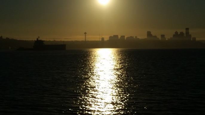
In Seattle we will visit the Space Needle for lunch and the Boeing Factory before catching the Victoria Clipper Service across to Victoria on Vancouver Island (Canada)
On the Island we will be staying at Naniamo, Ucuelet and Campbell River before journeying back to Vancouver, a night in San Francisco then home.
See you from San Francisco, Tony & Nan
Tuesday 6th September
At the airport. All good with my lithium spare battery once I showed the restricted items document at check in and that the battery was correctly prepared for travel.
Not so good with a roll of gaffer tape at customs.
Short flight to Auckland and even shorter transit. Airport security wanted all electronic and metal items removed from carry on baggage. No need to worry about tape although I did see a roll on the counter.The VX7, Garmin map62, Garmin Nuvi, LiFePo4 battery, phone, SPOT, travel clock filled up 3 trays. Security bloke was impressed. Problem was there was bugger all room to reload. Only two security screens operational for aĺ of the incoming flights. Slow but steady for the most part.
Flight to SFO uneventful and got some sleep. Arrived 12:45 local, transit to the Golden Gate Hotel then hit the hustings with a trip to Fishermans Wharf on the cable car and picked up an America The Beautiful Inter Agency Pass from the Maritime Museum.

Wednesday 7th September
Big Bus city tour today. Visit Star Fleet HQ, the Golden Gate Bridge, Coit Tower and many more.

Thursday 8th of September.
NOTE as this blog has been done on the phone and tablet, expect some editing and hyperlinks once I am home.
Average night sleep typical with Jetlag although it took longer to hit. Fell asleep around the right time and stayed that way for a couple of hours and was then in and out for most of the night until proper sleep took over some time in the morning. Thus was not at my peak today.
Nan and I searched for some metholayted spirits in the morning for our stove. Whilst searching the stores of San Francisco, Nan came down with another migraine so back to the hotel and bed before Elliott K6EL picked us up at 12:30 pm.

We headed out into a San Francisco fog to Mt. DAVIDSON W6/NC-423, a nice little 1 point summit right inside San Francisco that even has a bus stop at the trail head. I set up at the summit and, over a picnic lunch, made 14 x 20metre cw and 1 x 40 metre cw contacts. Quite a pile up on 20 and not at all used to it but managed as best possible. Recognised many calls from last year in VE7 and VE6. The activation lasted about 40 minutes before the chaser list was exhausted and it was time to head back. Good phone and data access here. No fees applicable.
Need to repack all our gear for tomorrow. Picking up a car and off to Yosemite National Park.
Friday 9th September
Woke up with a start. Had slept through the alarm and it was after 8:00 am. Quick breakfast and settle the bill then off to the car rental which was just over the road.
I had arranged the car with Alamo from home and completed all of the documentation so it was pretty quick. The online deal came with damage insurance and, because we had joined the Alamo Insiders club, our selected Toyota RAV4 had been upgraded to a Volvo XC60. It was only a few days later we discovered it had a sun roof!
Yosemite is a long day. Forget all the information (and google) that state 302 km/ 188 miles in 3hrs 40 minutes. It easily took us 6 hours that included a minor navigational error plus a lunch and fuel stop. The 120 hwy carries a fair amount of traffic and has speeds varying from 55 down to 35mph and down further to 25 mph inside the park. The road network in the valley was a bit of a mess as the parks people were trying out new traffic management of the normally one way roads. Thus we missed the sign for our House Keeping Camp as it was set up for traffic in the opposite direction. National Parks pass and camping fees applicable.
Managed to get some provisions and De- Natured spirits (metho) for the stove and caught the shuttle bus to the east end of the valley for a short hike to the base of Vernal Falls.
Note: the Half Dome Village has a supermarket type store plus a camping store. We found it generally better for provisions than the Yosemite Village store.
Saturday 10th of September
A big day planned. Back packs and hiking gear sorted and off to the Porcupine Creek Trail Head, located on hwy 120 or the Tioga rd a bit over an hours drive and 57 km from our camp. The carpark was already full at 9:50 am so we parked off the side of the road.

The objective was the North Dome via Indian Rock SOTA W6/SS-313 and 2598 metres high. The trail head starts at 2470 metres and gradually descend to a saddle on Indian Ridge. From there it is a 1km detour north up the ridge to the Indian Rock arch at 2542 metres. The summit is a further 700 metres on up the ridge, requiring a couple of rock outcrops to be skirted around (east side) before reaching the rock outcrop representing the summit. This can be climbed from the south but there is no advantage as the flat area imediately adjacent to the highest bit is well inside the activation zone accordin to the map contours.No phone or data acess at my activation position. Phone worked at the rock arch.

So, this is where I set up. It was very windy and warm; no shade. I strapped the squid pole to a dead pine branch and set up the doublet. The pole was soon on a 45 degree angle and the ants in the dead tree very much disturbed. I had coordinated with K6EL to start on 40 metres cw and Elliott was my first contact. It was then not long before the RBN found me and I had a pile up of chasers, mostly zero beating on the exact same frequency.There was also someone at strength 9 tuning up and another came up on the frequency and started calljng cq. In the end, I only worked cw on 40 metres; 11 calls in the log and 4 x s2s. After 1/2 an hour I was out of time and had to finish up if we were to reach the North Dome and get back before dark.

The North Dome is at 2300m and is a steady and at times steep descent. It provides great contrast views of the Yosemite Valley and the Half Dome. The return trip though is all up hill.Got back to the car a bit after 5pm and camp about 6:30 pm. Time for a scotch. Feeling a bit wrecked.

Sunday 11th of September
An easier day with 2 x 3.5 km hikes to Taft Point (morning tea) and the Sentinel Dome before driving down to Washburn point and then Glacier point that provides a great view of the Half Dome. Back into the valley for a late lunch at Bridal Vale Falls then back to camp. Had a brief swim in the river but opted for a shower as the river was bloody cold.


Monday 12 September
Yosemite to Mendocino 524 km / 325 miles. Google says 6.5 hours but took 8. Could not find coffee at Stockton but did at Peets in Santa Rosa. We drove the Obryne’s Ferry rd for some variety and it was possibly a bit faster as had fewer traffic spèed restrictions and road works. Navigation not helped as the downloaded CA topo map is now only showing major highways. Maybe this is the default global map? In order to avoid conflict in Yosemite, I disabled this map. Maybe this was the problem? Otherwise the Garmin Nuvi and OSM maps has been great.


Mendocino is a very pretty and layed back sea side town. Note to fellow cheapskates that the Harvest Market IGA has breakfast, lunch and dinner take aways. Fresh salads & meat, vegetables, clam chowder.
Tuesday 13th September
Breakfast at the hotel. Probably a bit too much. Lots of garlic! At least we both had the same meal. Seems to happen a lot! Thismorning we headed out of town, heading east on the Comptche to Ukiah road just south of town on the south side of Big River. Quest was for Mathison Peak, W6/NC-414

I had eyed this via google earth and knew to look for a sign for Escuela Ranch. This was as far as google could take me. We found the turn off but just around the corner was a sign stating “Private Property. Respect Our Privacy. Access only with permission”. So, I parked the car back on the main road leaving Nan in charge with her book and walked up. I found some derelict sheds, a communications tower, a house and workshop, a couple of cottages and a wood mill. No body seemed .to be around. Looked like the activation was not going to happen. With dubious phone and data access, I attempted to amend the alert but, it turned out that I managed to delete it. At about the same time, the property care taker (Mike) found me. I explained that I had spied the peak from Australia and all about Ham Radio and SOTA. Mike must have felt sorry for me; he normally working at Whistler BC in the company of numerous Aussie compatriots. Mike explained that Steve the second generation owner of the 80 acre property, purchased by his father who was involved with the National Forests and fire spotting, was quite specific on privacy but, as they were on a road trip, it was fine for me to undertake my activation and also bring Nan up with the car. Very lucky!

I set up just off the side of the main access road and down from the communications tower. I called right on my alert time on 20m and had a reply from Mike W9MRH. A sucessful exchange was sucessfully made despite deliberate interference from a person transimtting an infinitely long cq not only on my nominated 14.058 but also 14.062 to where I moved to. Thanks for nothing AH! 20m was very noisy anyway!
Moved to 40m. No replies to calls on 7.032 Not able to get a spot out. Unreliable data and phone coverage. Turned out I had forgotten to lodge my USA phone number with the Sota Watch SMS so the texts I did manage to get out were for naught. In the end of an hours activation, I did manage 3 further 40 m cw contacts plus broke into a net on 7.204 for 2 x ssb contacts to add a bit of security. ( Thus far, these are the only NA voice contacts I have had – KL7, VE6, VE7, W6)
Activation over, with a very patient Nan, we followed the road to the village of Comptche (General store) then headed back to the coast with our IGA lunch. Quiet day exploring the coast to Elk then back to Mendocino. Thus the first and possibly only activation of Mathison Peak was achieved.
Wednesday 14th September
Long drive north. Through the Avenue of the Giants, and into Oregon, leaving the coast and overnight at Grants Pass. Must have been tired as for a brief period, I turned into a side road but was driving on the left hand side! Old habits die hard.

Thursday 15th September
Short drive of under 100 miles to Mazama Village at Crater Lake. Slow drivers – those who can’t drive twisty roads without constantly being on the brakes are just as impossible here as in Australia. For that matter, so is the amount of used toilet paper in the bush off the side of the road!

No body around at the campsite check in so proceeded to Rim Village (can be difficult to get a car park here!) where we picked up some wraps for lunch before checking out the local views. We then proceeded on to the West Rim Rd and, despite the road works, ascended Watchmans Peak where we had lunch. Completed the day with a full circumnavigation of the lake and a side trip down to Pinnacle Valley. Wow, what a fantastic place this is!! Set up the tent and had a good meal at Annie Creek Restaurant. First night ever in the tent and new matresseses tonight.No phone or data access throughout most of the park.National Parks pass and camping fees applicable.
Friday 16th September
After a good nights sleep and camp breakfast, Nan and I head off to Mt. Scott. Highest peak (2722m) in the park and also Sota summit W7O/CS-003. Worth 8 points and, with a successful activation , would bring my activators tally to 1000 points and Mountain Goat.


From the trail head, it is 2.5 miles wih a 1200 foot elevation gain ( will add metric later) to the summit where there is an old fire tower – similar to that of Watchman’s Peak. The climb is via an established trail, not overly difficult and quite pleasant in the earlier part of the day. Phone access became available on the ascent and I was able to text K6EL with an update Good phone access on the summit but data access was not reliable. At just over 30 minutes earlier to my alert time, my first contact was a 40m S2S with a lonely KE7BGM. I then moved to 20m where, with the help of the RBN and a spot from Elliott K6EL I was easily able to qualify the summit, Tom W7RV giving me the 4th confirmed contact and MG. Finished off with a second S2s with NM5S then on 40m with K6EL. Chatted to quite a number of enquisitive visitors so appoligies if I sounded distracted. Activation successful. Just over 90 minutes. Much quicker on the way down.

After lunch at a very packed Rim Village, Nan and I braved the West Rim road works and ended up camping at Odell Lakes. Pretty basic facilities here and noisy as there is a major train line (not seen, on the other side of the lake) It was a 3 degree start from Mazama Village at Crater Lake but should be warmer here at the lower altitude?
Saturday 17th September
Mild and approaching hot all last night. Noise across the lake from the aforementioned train line is such that I could not recommend camping or staying here. Camp site was full up by the time we had left. No showers so had a swim the night before. No phone of data access here.

Heading to Cascade Locks on the Columbia River to the east of Portland in Oregon. Sorted out the low tyre pressue warning on the Volvo XC60 in Eugene by putting in some more air and recalibrating the sensors. This is all in the online manual but is not accessible when mobile. As we headed towards Portland, the weather became more threatening and we ended up in heavy rain, low cloud and heavy traffic as we navigated the freeway interchanges to alter our previous north travel direction to the east. A visit to Larch Mountain , W7O/WV-062, was abandoned. A pity as it would have provided a great overview of the valley on a clear day. Instead we followed the Old Columbia River scenic road and looked at some water falls;stopping at Multnomah Falls for lunch and the view.
Next to find our camp site. We did look for dryer alternatives but everything was already booked.Found a sheltered spot to set up the tent then transported it to our allocated site at the KOA camp ground. There was one benefit of all this; I managed to grab a room at the Paradise Inn at Mt. Rainier N.P for the following night
Camping facilities here are OK without being lavish. No camp kitchen. After dinner at a Family Restraunt, we returned to the only dry place other than the toilets. This being the gaming room that was not being used. Pluged in the camera, tablets and phone for a charge. Did some work on this blog. Lousy WIFI so set the phone up as a hot spot.
Sunday 18th of September

Steady rain over night but stopped some time in the early morning. Inside the tent is completely dry. A basic breakfast of cereal and coffee then completed taking the tent down and commenced our journey to Mt. Rainier N.P. Our route would take us mostly due north to Randle then east through Packwood then on to Ohanapecosh where we had originally intended to camp. Not far from here is an unactivated summit, RTTY Mountain W7W/PL-064 of which I had an alert out for 23:00 hrs utc. With the weather of the previous day and an unknown dirt road for access I edited the alert to first doubtful and later as extremely doubtful.

Our route north on Forest Rd 25 took us close to Mt. St. Helens, the volcanoe which dramatically exploded 36 years ago. South of Randle is Forest Rd 99 that takes one to Windy Point and offers views of both the mountain (in fine weather) and the destruction it caused. Nan and I were lucky to time our visit with breaks in the weather that gave a good view from the Windy Point lookout.
Whilst here I scanned the lie of the terrain and thought there could be enough prominence for a Sota summit on the ridge beyond the lookout. Checking the Sota Spotter app for nearby summits, I discovered Windy Ridge W7W/LC-048 was under 1 kilometre away. Back down the hill and a quick warm lunch cooked on the Trangia (was to have been dinner) then I left Nan with book, camera and binoculars and made a dash for the summit, first editing the pervious alert to a new time and summit.
Access was quite easy. First up some 400 stairs then following a walking track off the side of the ridge. I left this in a saddle and made a direct line for the summit. Set up the squid pole on a dead Spruce tree stump. This proved to be quite rotten but on the second attemp, made a satisfactory anchor point. The doublet was soon up and I was on air at 20:45 utc. I could here K7PX calling cq sota and being called by KXOR without luck. I also tried for the S2S but with time pressing, moved down to my alert frequency and put out some calls. Not much initial response so put a spot out at around the same time the RBN picked me up. Good phone and data access.National Parks pass or North West Forest Pass / day pass required.

First in the log was Jerry NG6R in LA, followed by 5 further chasers on 14.058 over the next 10 minutes. I was called by EA2IF to whom I gave 559 and received 329, a long contact attempt over 4 minutes. Now on 1004 activation points! Good phone and data coverage here with AT&T. Time to get going, dismantle the station and ran back down to the car and Nan and I headed back to Forest Rd 25, 15 miles away to the east. Slow going due to traffic, speed limits and at times extremely poor road surfaces.
We made it to Paradise Inn by late afternoon. Managed to get a good view of the majestic Mt. Rainier (4392m) above us.Our room at the Paradise Inn was warm and dry. This gave us a chance to dry out a few items and also get everything packed up for when we return the car in Seattle. Nice meal at the restaurant then a look around the huge Inn. No phone or data access at the Inn.

Monday 19th of September
Woke to rain, low cloud and minimal visibility. Glad we were not in the tent. Breakfast at the cafe inside the Inn then headed down the mountain via the western access road. Stopped at Longmire for coffee and a look around. There is also a lodge and parks information station here.

Discovered the N.P passport and stamp program here. Bought one and had it stamped. Pitty about the other parks we visited this year and those in Alaska last year. A quiet drive into Seattle, the waypoints set on the Garmin Nuvi made our navigation to the hotel quite simple, just had trouble seeing where the Alamo Car Rental place was. Fresh seafood and a bottle of local wine for dinner.
Tuesday 20th of September
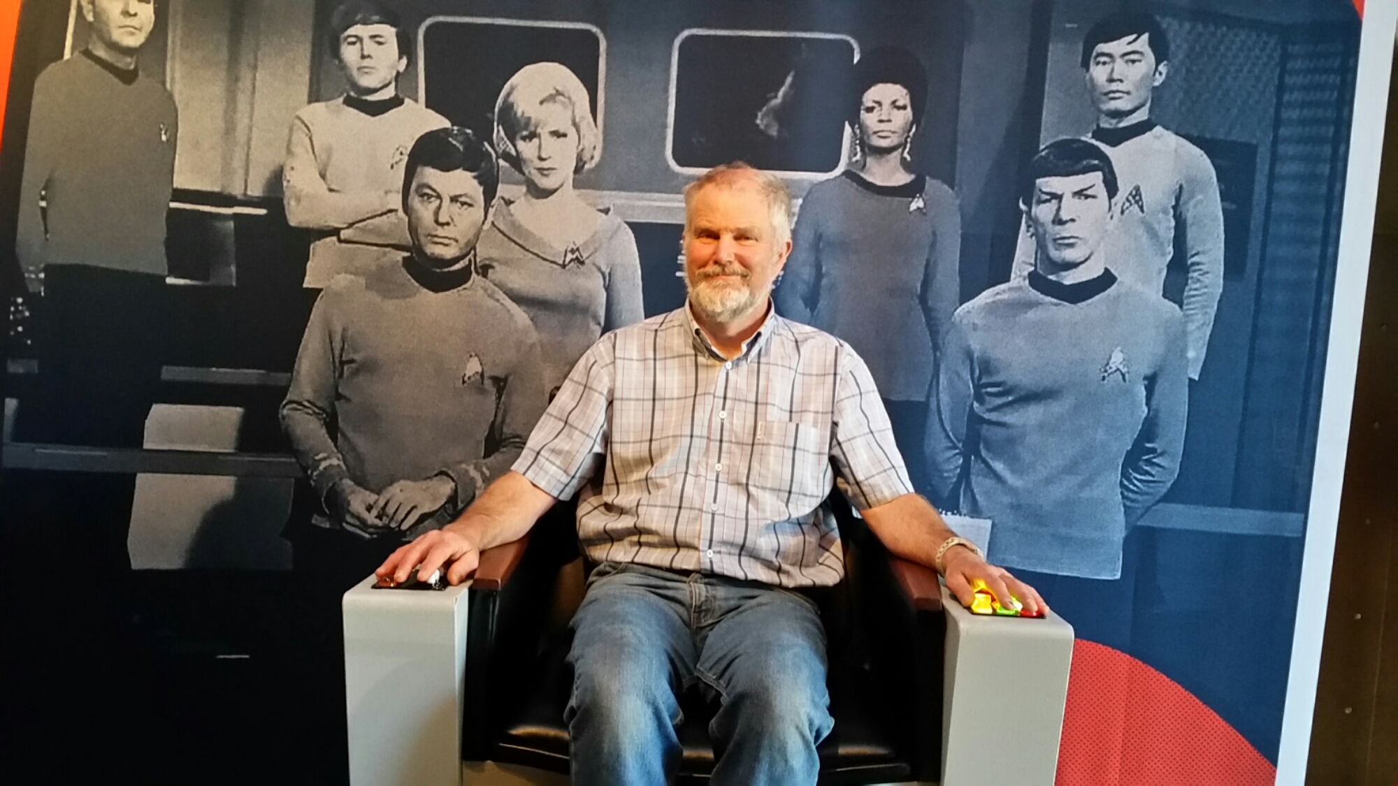
Day planned turned out to be a blast. First up the Dale Chihuly Garden Glass exhibition. Second, lunch at the Space Needle and finished up at the EMP Museum for the Star Trek, SCFI and visual arts expo. Light salad for diner tonight.


Wednesday 21st of September
Our last full day in Seattle. Visit to the Boeing Factory and Future of Flight museum in Everett noorth of the city of Seattle. No cameras or phones, actualy nothing except the clothes you are wearing, can be taken into the assembly areas.The building is huge and accomodates the construction of multiple 747, 767, 777 and 787 planes at the same time.

The cars in the foreground of the above picture are real. The factory is huge!
Back into Seattle for a late lunch and back to the Star Trek to pick up some merchandise for Candace, Lachlan and Cameron. Yes, I did purchase something too!
It will not be a late night tonight as we ahve an early start in the morning.
Thursday 22nd of September
Arrive at the Victoria Clipper Service at Pier 69 at 6:30 am for a 7:30 am departure to Victoria, Vancouver Island, British Columbia, Canada. We should arrive by 10:30 am and from here pick up a car from Budget and head north to Naniamo. We will meet up with our youngest son Cameron here and explore some of the Island.
An interesting fact is that the Victoria is the capital of British Columbia and is below the 49th degree of Latitude which forms the border with the USA. This was a strategic move to prevent the USA claiming all of Vancouver Island. Also, back on the mainland, Fort Roberts is USA territory that, by land, is only accessible through Canada.
Up at 5:30 am this morning to enable us to be at the Victoria Clipper terminal by 6:30 am. With all our luggage, it is just as well the direction of travel is down hill. With bags checked in, it was a simple breakfast at the terminal before boarding. We selected an upper deck window seat.
It is 2 & 3/4 hours from pier to pier. Victoria was a hive of activity in preparation for aroyal visit. Either we were early or they were behind schedule. Not a hard walk lugging the bags to the Budget Car Rental terminal and we were soon on our way in a Toyota RAV4 to the BC ferry terminal at Nanaimo to pick up Cam.The 105 kilometres took longer than anticipated due to a navigational error (wrong ferry terminal),, traffic congestion and road works.We sèm to attract the latter when away or is it just a narrow window of opportunity to get things done? In North America it is not uncommon to have to wait for a pilot car for escort through road works.
Finally found Cam at Departure Bay rather than Duke Point and found a place for a late lunch, then to our accommodation; an older motel on the highway that looked like rooms could be booked by the hour. With 3 nights scheduled, could a long service discount be applicable??
Room was better on the inside than out but the view of the industrial waste bin out of the bedroom window probably sums up what I think of Nanaimo from a tourists perspective. The old quarter is quaint with some nice restaurants but does not justify a stay of more than one night.
Le Joke?
Friday 23rd September
Back down to Victoria. Cameron has been in BC for over 2 years and had never seen the capital. We visited last year and the highlight is the Butchart Gardens just out of town. Very touristy with lots of shops and a Chinese quarter that was certainly cleaner than that in San Francisco. Lots of people looking at shops pretending to be interested, maybe to justify their reason for being there in the first place. There was a really big camping supply store (MEC) and it even sold methylated spirits – just don’t need any now! Preparations for the royal visit now in full flow – well we are here, what more could they want?
Victoria does eating houses well. Last year we ate at the Bard and Banker Pub, this time at the Irish Times. Being responsible drivers, only had one cider then a further look around before heading back north. Road works and traffic even worse than yesterday. Was it the weekend escape or a mass exodus due to the special visit on Sunday? Don’t recall care but it took 2 1/2 hours for the 105 km drive back. Dinner at a Greek restaurant in the old quarter was good.
Saturday 24th of September
As the royals were preparing to conquer Victoria, we came to the sharp conclusion that there is bugger all of interest for the average tourist in Nanaimo. One of the listed 101 best things to do is a fitness regime walking up and down all the steps in the port district. So, we headed north towards Parksville and on the way looked at access to Cottle Hill VE7/NO-021. My notes and Google Earth showed an access road to the communications site from Alta Vista Drive off Lake view drive with no barriers. This is also in the middle of a new well to do housing estate. The closest thing I found for access in the general area was a dirt road with a high cyclone mesh gate – locked- preventing access and stating video surveillance. A further look around into various trail heads was not too encouraging with the time permitted.
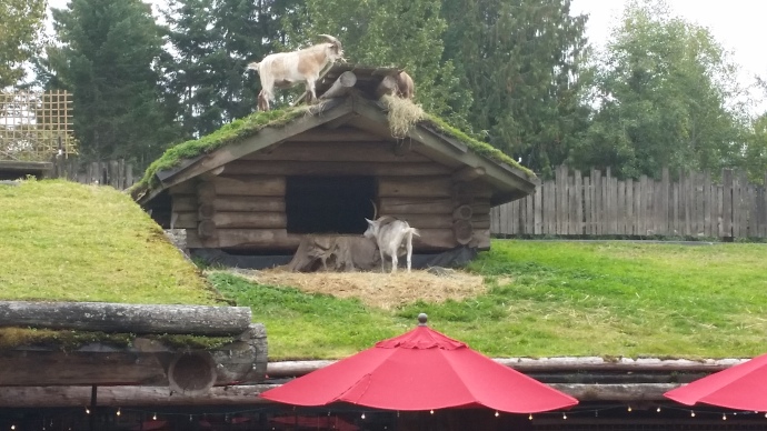
So, continued north to Parksville (don’t bother other than for a nice cafe for lunch) then to Coombs to view the Goats on the Roof. A great example of commercialism here. Coombs is a non descript place in a nondescript area but they have established a renowned reputation for a great market and produce and have the crowds flocked in! Still, not much competition. The market / supermarket is a Norwegian log building with goats living on the roof.
After this we visited the Little Qualicum falls that were quite spectacular, enhanced somewhat the with the rain we were now experiencing.
Back into Nanaimo in now heavy rain. The activation would have been canceled anyhow. Not wanting to drive anywhere, we had an extremely average meal and less than average glass of wine at the family restaurant over the road. I slept sound enough to he tones of rain drops falling on discarded furniture in the waste bin.
Sunday 25th of September
We fill up the car and back track our way through Coombs towards Ucluelet on the wes coast of Vancouver Island. Our route takes us past Cathedral Grove but, whilst listed as a major attraction, only has parking for an RV and a dog on a moped. Will we be lucky on the return? (NO!) The road cross the island is very twisty and can be slow with traffic. Being Sunday no road works stoppages. As we wound our way through the mountains, the rain became quite persistent and both mountain tops and valley were clouded in. Arrived at the Little Beach cabins that overlook the same name beach and are very nice. Walked down to the light house and a 2.5km on the southern section of the Wild Pacific Trail.No luck with thd local seafood co op restaurant for dinner but found a charming little place called Matterson House that had a table for 3 on te the verandah.
Monday 26th September
Today we visited the Pacific Rim National Park. Similar to National Parks in the USA, a pass for access is required at most sites. Choices are family 4 hour, day or annual. Last year we took out an annual pass which provided the best value as a day pass (valid until 4pm the day after issue costs just under $20 CAD.
This section of park consists of rain forest of Red Cedar and Hemlock reaching riht daown to the sea shore and there are a number of board walks (in varying states of repair) that allow access. Thinking we would need to use the second day to rach all the sites, I was a little disappointed to find we had exhausted them all b mid-afternoon. Had a look at Tofino (a bigger tourist town in the north) before returning back to Little Beach. As time allowed, I set the KX3 up on the beach amongst some rocks and driftwood. With the antenna orientated north /south I had a nice contact with John N6JW in Riverside California on 20m phone. I could also hear quite well on 17m phone a conversation between operators on Easter Island and Santiago Chile. Some activity on 40m phone and 1 conversation on 60m. Lots of 30m cw but all on 10.116; I decided not to add to the confusion.

Seafood co op still closed. Not much choice for dinner. Fish and Chips with salad at the Family restraunt which was OK. Nan not to well this afteroon. A bug thoughtbto have been beten has struck back.
Tuesday 27th of September
Not a great night last night for Nan. We all slept in. With the sun finally showing, I set out on a solo jaunt along the Wild Pacific Trail, following the rocky coast northwards to a stand of old growth Cedar trees. All up around 16km round trip Easy going in around 4 hours. Back at the cabin, I cleaned up and had a cat nap in the sun on the verandah.
Wednesday 28th of September
My birthday today albeit was yesterday if I was at home. Today we travel back across the Island through Port Alberni and the infamous Coombs and head north to Campbell River where we are having diner with friends of Nan’s from Melbourne.
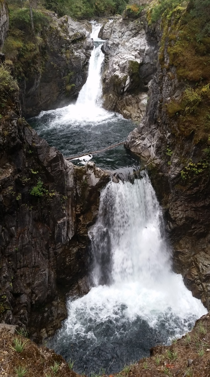
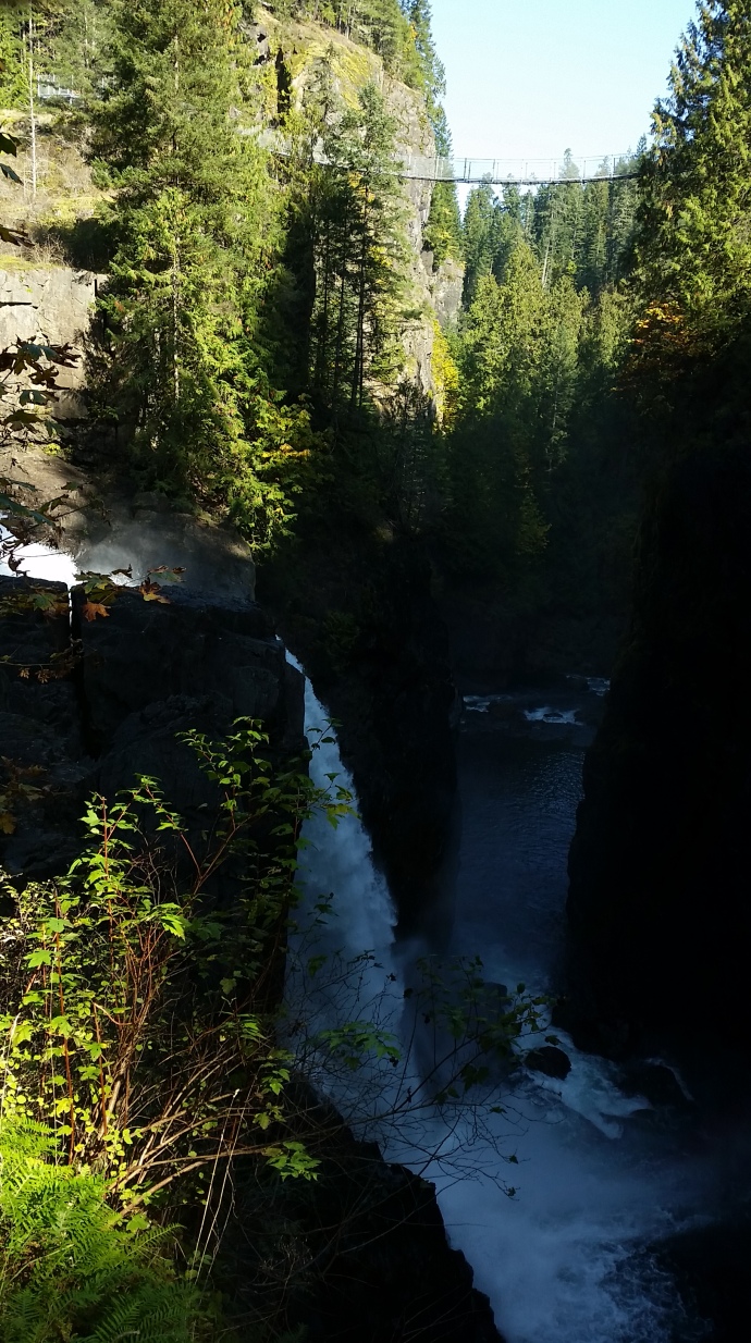
The drive across the island west to east was much quicker than expected. Maybe the early start? We arrived at Campbell River by 11:00 am and sought out tourist information plus a place for a late morning coffee and bite to eat. With a plan established, we set out to Elk Falls, on the way passing by Haig – Brown House – our abode for the next 3 nights.
We visited the suspension bridge, some waterfalls and a walk down the upper section of the canyon to the power station before heading back up to the car then down to Haig – Brown House to check in; after which we visited Susan & Bill from Melbourne who live in the south section of Campbell River for a casual dinner.
Thursday 29th September
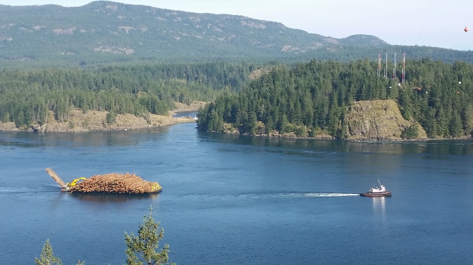
 Another bad night for Nan and we spent the morning at the doctors and then the pharmacy. Lunch at Fogg Duckers then we caught up with Susan at Haig-Brown House from where we headed north for a walk to Ripple Rock followed by a second dinner with Susan and Bill and a beach fire for coffee and cake.
Click on this link for the interesting story of Ripple Rock and the biggest ever non-nuclear explosion!
Friday 30th September
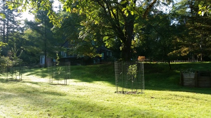 With all the driving, walking and lack of good sleep, an easier day was had. We had a tour of the Haig – Brown House then Visited the Campbell River Museum. Lunch at Daves where Cam had a Nanaimo Bar. Back at Haig – Brown House, I set up the KX3 down by the river and had a tune around the bands, listening out for any activity out of VK2 from the special Sota weekend in the Snowy Mountains. Not surprisingly, nothing heard. Nore was anything from JA or VK4 which were also being activated. Tuning on the IARU beacons, KH6RS was heard with reports 339 to 569 on 20 metres and a marginal reception on 17 metres. OA4V was weak on 17 metres and I may also have heard bits of ZL6B on 17 metres.
I could hear a reasonable amount of activity to the south on 20 metres plus some activity from Washington and Oregon on 40 metres.
Time to pack up then out for a meal.
Saturday 1st of October.
Heavy rain overnight and into the morning. I found the antenna for my VX7 that had fallen out of my bag down near the river. Departed in the rain and headed south to Naniamo where we caught the early afternoon ferry from Departure Bay to Horseshoe Bay on the main land. Local bus into down town Vancouver and we checked in at our hotel; A bit of luxury tonight thanks to Fly Buy points.
Sunday 2nd of October.
A lazy morning. had a good meander around the Vancouver Downtown port district where the cruise ships berth. The ships cruise the inside passage to Alaska and are huge in size. In my mind, whilst not 5 star, hitching a ride on the mail ship could be more fun!
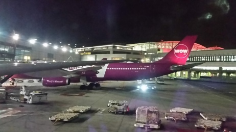
Train to the airport in the early afternoon for an evening flight south to San Francisco.
Flight on United uneventful. Their in flight entertainment app did not work on any of our devices so it was more Hill Climb Racing! Overnight close to the SFO airport.
Monday 3rd of October.
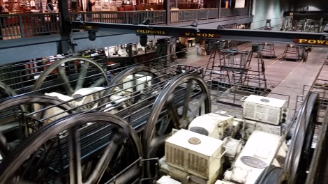 Spent most of the day in SFO, re-visited the Maritime Museum and went to the Cable Car Museum. Both are must visit. Fisherman’s Wharf area is very touristy and did not have great appeal to us. Got good value from our cable car day passes. Price increase from $17 to now $20 USD.
Next adventure destination?
Back to the hotel for a 4:00 pm pick up to the airport.
Check in, Hill Climb Racing, and the journey home via Auckland begins.

Recent Comments