

Just off the summit looking for some protection from the gusty southerly wind.
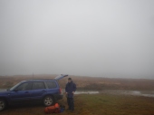 Close to 9:30 am at Pretty Valley causeway where there is ample parking. Clothing layers, jackets and overpants fitted plus pack cover then we are on the trail by 10:00am, filling out the NPWS intention book on the way out.
Starting out from the causeway at around 1650 metres, the first 2 kms involve a gradual but steady climb along the fire trail to above 1800 metres. Just past this high point is a memorial cairn on the RHS to Bogong Cattleman Ben Cooper.


So far there has been no need to pick up any water but there has been ample opportunities at the numerous creeks crossing the track.
Salt Camp Creek at 1750 metres is a further 1 km on then within 700 metres the main Fainter Spur at 1820 metres is reached. At this point the fire trail swings hard to the left (west) and at 1830 metres, where the fire trail seemed to loose altitude and skirt around the side of the mountain, Allen and I went cross country towards the summit (we could not see it due to the fog). In the end we picked up a faint rocky outline. Using our Garmin GPS units to confirm what we could nearly see.
After a couple of false summits, Allen first reached our goal, marked with a sizable rock cairn with the remnants of a metal trig post in it. Just the thing to attach Allen’s HD squid pole to and my light weight doublet.


 We arrived some time after 4:00 pm, found the hut then set up our tent in the saddle come horse yard clear of all the poop. With everything wet, we gave up on getting a fire going; instead powering up the gas fired Trangia Stove and having a hot freeze dried meal and a drink. With darkness and the associated cold soon upon us, it was time for the tent and a very early night. Slept well!
 Heavy dew on the tent in the morning but the sun was out and we could see the mountains which were invisible to us yesterday. One at a time we packed up our sleeping gear then removed it to a nearby sunny patch. The tent was left up but inevitably was packed up damp.
Breakfast, final pack then depart by 8:30 am.

The track to the north of Bogong Jack Saddle has irregular vehicle traffic. It is closed to the public as are the numerous intersecting tracks but I assume access is granted for the horse yards?

From Big Hill it is all downhill along the aforementioned fire trail. At the sign posed junction (1050m) of West Kiewa Logging Rd and Roper Spur track, we checked the map and GPS before descending on the later.
Roper Spur track starts off steeply and gets steeper. The map does not show most of the switchbacks. Beware that just over 1km down this track is a junction where one has to turn sharp left and down hill rather than following the trail straight ahead (soon leads to a dead end)
The now very steep descent has lots of loose rock until it reaches the power pylons above the Bogong High Plains Rd which is soon greeted. The van is parked some 500 metres at the Roper Lookout carpark which is towards Bogong Village.
WX has remained sunny and is quite warm compared to Saturday. Glad to have a water supply in the car. Glad the car was still there!
Allen & I head south back to Pretty Valley to pick up the Subie and possibly activate Mt. McKay.
 All proceeded well until reaching the Pretty Valley Rd, finding it closed due to a Mountain Bike Event.
These occurrences really piss me off.
There was no mention of the closure on the Falls Creek Website.
There were no signs indicating any closure the previous day.
The signs indicated the closure for Saturday and not Sunday.


From Mt. McKay inside of 45 minutes I made a total of 22 contacts consisting 4 x 40m & 4 x 20m CW that includes S2S with Peter VK3PF/4, John VK6NU & EU dx with UT5MH.
With lots of storm cells in the area, I was glad to be undercover but was very conscious of possible lightning strikes. Ready to bail out in an instant whilst hopeful the considerable communications tower would be a more attractive target than my puny wire. That said, not a great place to be in a lightning storm. Fortunately there was none today.
Decided not to camp out overnight due to the storms and that things were already a bit damp. Time to head home.
For me, these types of trips are a natural progression of my Sota activations and probably the only way to reach really remote summits. Next step will be multi day expeditions.


Trip Stats:
Distance traveled = 30.3 km.
Start – Pretty Valley causeway = 1550m, Finish – Bottom of Roper Spur = 596m.
Mt. Fainter South = 1883m, Big Hill = 1285m.
Accumulated ascents = 964m, accumulated descents = 1914m.
Total trek time = 26hrs & 37 minutes, moving time = 7 hours, average 4.3km/h.
I purchased some extra gear specific for use on this trip and future occasions which will be soon added to the Sota Gear Page. Most of these items can also double up for work use over winter.
A Sea to Summit Compact Thermolite Reactor sleeping bag liner.
Columbia “Omni Heat” neck gaiter, beanie and Go To down vest.
Gas burner for the Trangia stove.
XTM 200 merino pants base layer.
Patagonia Quandary hiking pants with DWR
Caldera Nylon Belt.
The Sota Gear page will soon look like a camping and bush walking store!
Other summits on the Bogong bucket list are Mt. Bogong and Mt. Nelse giving me all of the top 8 VE summits.
As usual, Spot Tracker via APRS VK3CAT-13 was in use.
Allen VK3ARH BLOG of this trip.
Maps used Garmin Topo Australia & New Zealand V5
Spatial Vision Bogong Alpine Area Outdoor Recreation Guide. bushwalking.
More detailed trip notes.Bogong Alpine Area Trek April 2017
Many thanks to Allen VK3ARH for instigating this trek and to Warren VK3BYD for local knowledge support. GPX file available on request.

Good effort Tony and Allen, pity about the weather. Unable to chase as much as I would liked.
73
Ron VK3AFW
A good trek, shame the weather didn’t treat you better.
The cyclists are a pain in the proverbial! It amazes me that these people think it’s OK to create havoc on pubic roads, but sadly it’s very frequent in the high country. I too generally check the local and Cycling Australia web sites before heading up the hill but even then you can still be caught by surprise.
Still, that’s what a bull-bar is for, isn’t it? 🙂
Cheers
Bernard, VK2IB